Hidden Ecosystems Under Threat: New Research Reveals Urgent Need to Protect Earth’s Fungal Networks

For centuries, humanity has focused its conservation efforts on the charismatic megafauna and lush forests visible to the naked eye, while the planet’s most vital biological infrastructure has remained largely out of sight and out of mind. A groundbreaking study published in the journal Nature, led by the Society for the Protection of Underground Networks (SPUN), has fundamentally shifted this perspective by mapping the vast, intricate webs of mycorrhizal fungi that underpin terrestrial life. The research reveals a stark reality: 90 percent of the world’s most critical fungal biodiversity hotspots currently exist outside of protected areas, leaving these essential "ecosystem engineers" vulnerable to human-driven degradation and climate-related instability.
Mycorrhizal fungi function as the planet’s circulatory system. These microscopic organisms form symbiotic relationships with the roots of the vast majority of terrestrial plants, facilitating a high-speed exchange of nutrients and water. In return, plants provide the fungi with carbon-rich sugars generated through photosynthesis. This underground trade is not merely a biological curiosity; it is a global carbon sink. These networks are responsible for drawing approximately 13 billion tons of carbon dioxide into the soil annually—a figure that represents roughly one-third of all global fossil fuel emissions. By neglecting these networks, the researchers argue, global climate strategies are operating with a significant blind spot.
A Chronology of Discovery and Mapping
The path to this discovery began in earnest in 2021, when SPUN launched its ambitious world mapping initiative. The goal was simple but daunting: to aggregate disparate data points into a cohesive, high-resolution atlas of underground life. Before this, scientific understanding of fungal distribution was fragmented, often limited by geographic biases and a lack of large-scale genetic sequencing.
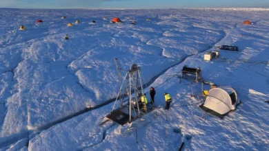
By mid-2025, the effort reached a critical milestone. Utilizing a massive dataset of 2.8 billion fungal sequences collected from 130 countries, researchers were finally able to generate predictive biodiversity maps. This project represents the first time such an expansive application of fungal sequencing has been utilized to create a global resource for policy and conservation. This effort was supported by an international coalition of 96 "Underground Explorers" and over 400 scientists, who have been traversing diverse and remote terrains—from the Guinean forests of West Africa to the temperate rainforests of Tasmania and the Cerrado savanna in Brazil—to sample soil and catalog fungal taxa.
The Science of Soil Stability
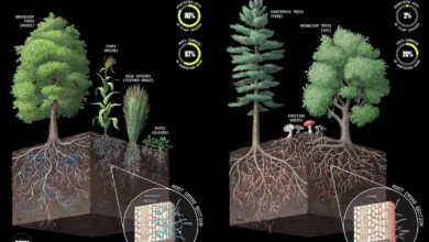
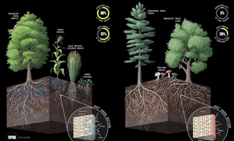
To understand the scale of the crisis, one must first understand the function of these organisms. Mycorrhizal fungi are divided primarily into two categories: arbuscular mycorrhizal and ectomycorrhizal. Both play distinct but equally vital roles in soil architecture and plant health. By binding soil particles together with their thread-like hyphae, they create stable soil aggregates, which improve water retention and prevent erosion.

Beyond structural support, these fungi act as a defense system. They can suppress soil-borne pathogens and help plants navigate extreme climate conditions, such as prolonged drought or nutrient scarcity. As Dr. Toby Kiers, Executive Director of SPUN, noted in recent discussions, the colonization of land by plants 450 million years ago was only made possible through the precursor of these fungal networks. Without them, the modern biosphere, including human agriculture, would be unable to sustain itself.
Quantitative Data and Geographic Vulnerability
The data presented by the research team is sobering. While the study identified key biodiversity hotspots—regions with high species richness and high levels of endemism—it found that a mere 9.5 percent of these areas are currently afforded any form of legal protection. This gap suggests that current conservation paradigms, which focus on land surface features like topography or forest cover, are failing to account for the "dark matter" of the ecosystem.
The implications of this oversight are far-reaching. If these networks are disrupted by intensive agriculture, deforestation, or urbanization, the secondary effects are catastrophic. Forest regeneration slows significantly because young trees lose their primary source of nutrient uptake. Agricultural yields, which depend on the nutrient-cycling services of fungi, face heightened volatility. Furthermore, the capacity for soil to store carbon is severely compromised, potentially releasing stored carbon back into the atmosphere and creating a feedback loop that accelerates global warming.
Official Responses and Academic Perspectives
The publication of these findings in Nature has sent a ripple through the conservation community. Lead author Dr. Michael Van Nuland, the lead data scientist at SPUN, emphasized that these maps are intended to be more than just academic curiosities; they are operational tools. "Food security, water cycles, and climate resilience all depend on safeguarding these underground ecosystems," Van Nuland stated.
The project has garnered significant support from high-profile figures in the environmental space, including conservationist Jane Goodall and authors Paul Hawken and Michael Pollan. Their involvement underscores a growing consensus that the "fungus blindness"—a term coined to describe the historical neglect of fungi in scientific and social discourse—must be corrected.
Dr. Merlin Sheldrake, SPUN’s impact director, echoed this sentiment, arguing that the new atlas provides a clear mechanism to move beyond awareness into action. "These maps help alleviate our fungus blindness and can assist us as we rise to the urgent challenges of our times," Sheldrake said. From a policy perspective, the utility is clear: governments and NGOs can now overlay these maps with existing protected area data to identify corridors where underground biodiversity is at risk and prioritize them for conservation status.

Broader Implications for Global Restoration
Perhaps the most practical application of this research lies in the field of ecosystem restoration. Historically, attempts to restore degraded landscapes—such as replanting forests after wildfires or reclaiming land from industrial use—have focused almost exclusively on the visible flora. If the underground infrastructure is not present or is dysfunctional, these efforts often fail or require excessive artificial intervention.
Dr. Alex Wegmann of The Nature Conservancy pointed out that restoration practices have been "dangerously incomplete" due to this above-ground bias. The SPUN maps provide, for the first time, quantitative targets for restoration managers. By knowing what a healthy, diverse mycorrhizal community should look like in a specific region, practitioners can incorporate fungal inoculation or soil management strategies to ensure that the ecological foundation is restored alongside the trees and shrubs.
Looking Toward the Future
As the climate continues to change, the resilience of our ecosystems will be tested. The ability to map these fungal networks provides a new layer of intelligence for climate adaptation. For decision-makers in law and policy, the integration of these maps into environmental impact assessments could prevent the inadvertent destruction of irreplaceable fungal hubs.
However, the task remains massive. With only 0.001 percent of the planet’s surface sampled for this specific level of fungal detail, the current database of 40,000 specimens and 95,000 taxa is only the beginning. The ongoing efforts of the "Underground Explorers" in remote regions like Bhutan, Mongolia, and Ukraine suggest that as more data is collected, our understanding of the complexity of these systems will only deepen.
The shift in perspective is becoming institutional. As Jason Cremerius, SPUN’s chief strategy officer, stated, the objective is to ensure that underground biodiversity becomes as fundamental to environmental decision-making as satellite imagery. If the goal of the next decade is to meet global biodiversity targets and mitigate the impacts of the climate crisis, the unseen world beneath our feet can no longer remain a footnote in the environmental record. It must be at the very center of the map.