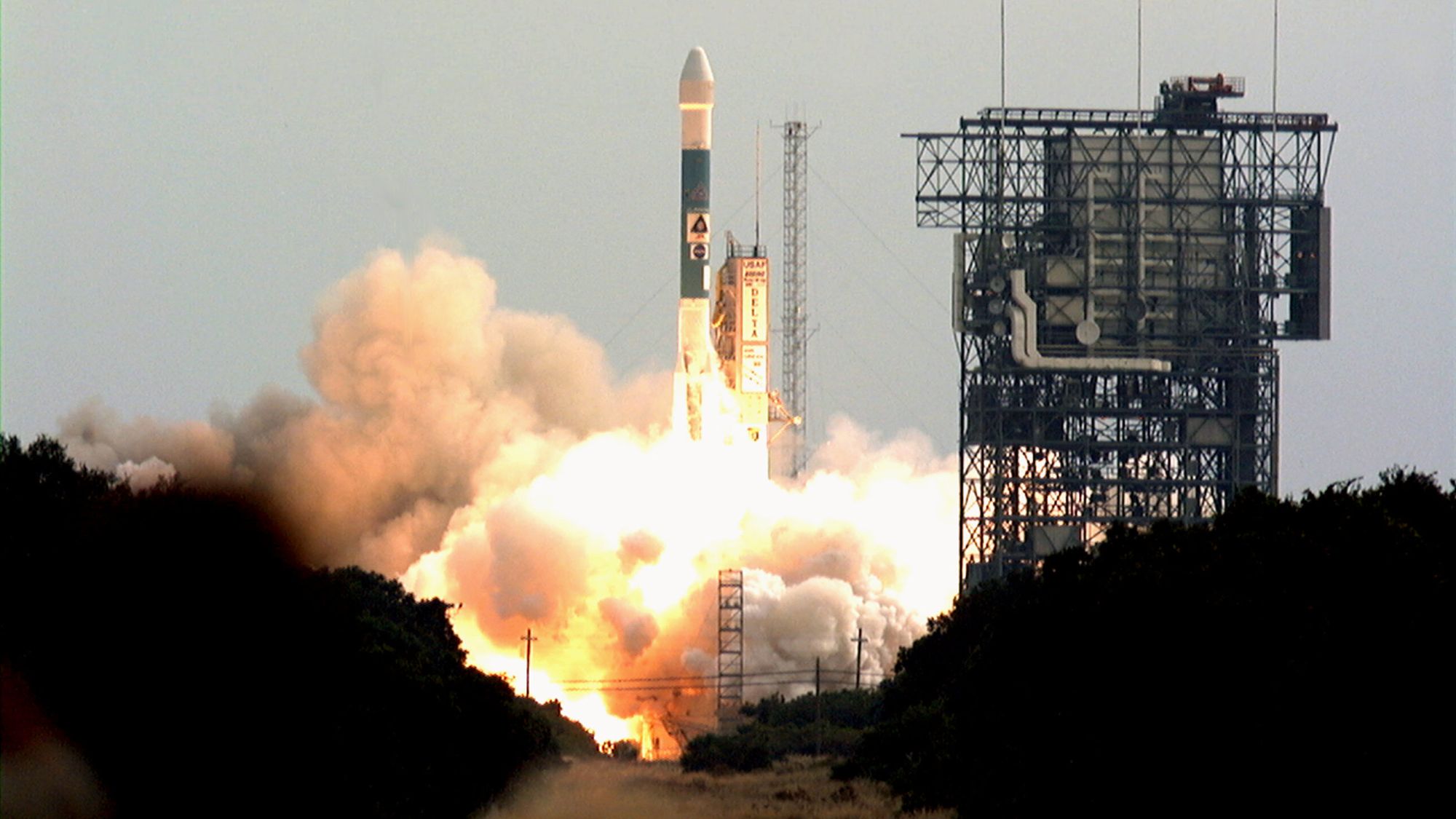
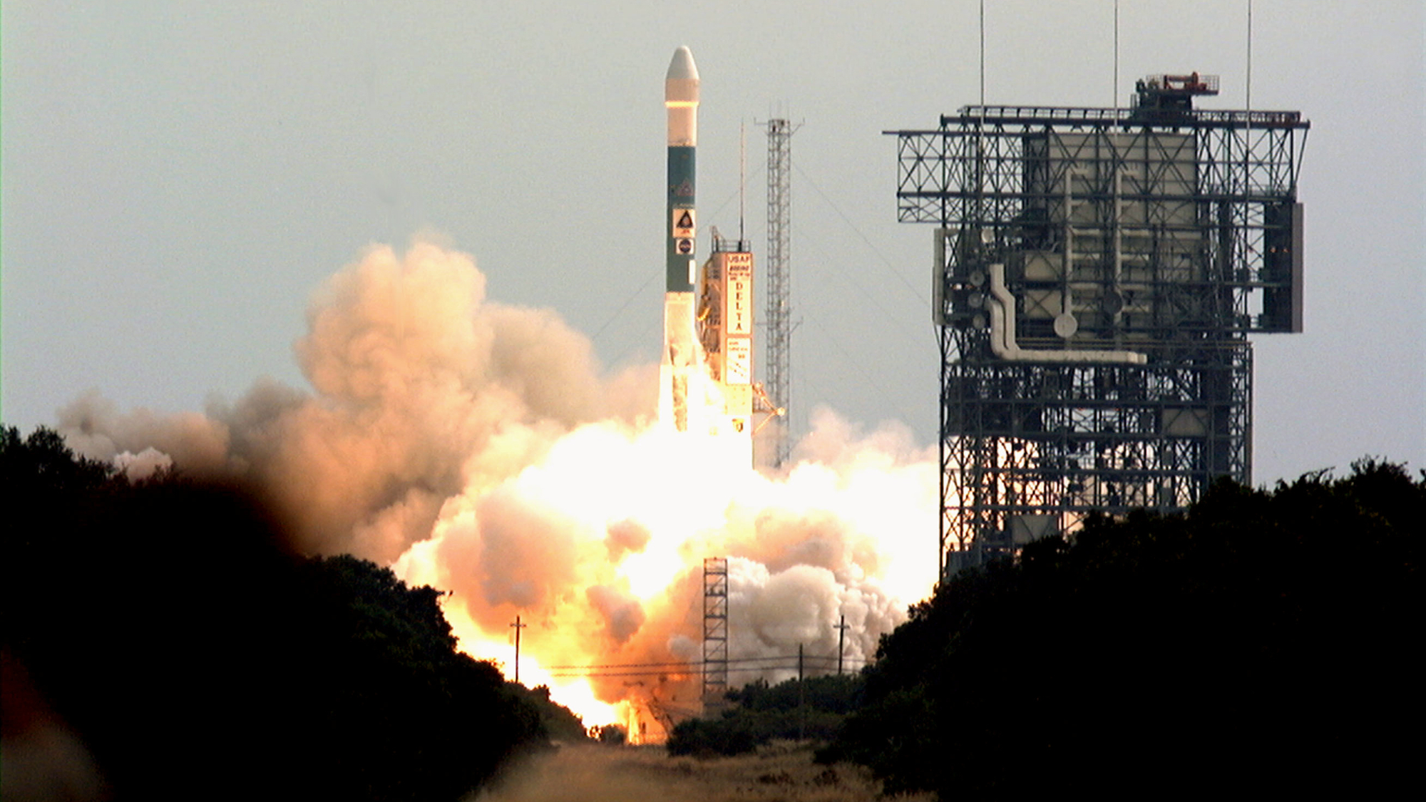
On November 7, 1996, NASA launched the Mars Global Surveyor mission, marking a pivotal turning point in space exploration that effectively ended a two-decade-long hiatus in American missions to the Red Planet. This ambitious project, launched atop a Delta II rocket from Cape Canaveral Air Force Station, represented the first successful mission to Mars since the Viking program of the mid-1970s. By the time it arrived at its destination, the Mars Global Surveyor (MGS) would fundamentally reshape the scientific community’s understanding of Martian geology, atmospheric conditions, and the potential for past and present water activity.
A Long-Awaited Return to the Red Planet
The launch of the MGS occurred at a time when NASA was pivoting toward a "faster, better, cheaper" strategy for planetary exploration. Following the loss of the Mars Observer in 1993, the agency faced immense pressure to prove that robotic missions could still be achieved with high reliability and significant scientific yield. The MGS orbiter was designed not merely as a solo explorer, but as a robust platform that would act as a critical communications relay for future surface assets.
The spacecraft, built by Lockheed Martin, was equipped with a suite of sophisticated instruments, including the Mars Orbiter Camera (MOC), the Mars Orbiter Laser Altimeter (MOLA), and the Thermal Emission Spectrometer (TES). These tools were intended to map the planet’s surface with unprecedented resolution and characterize the minerals present in its crust.
Chronology of a Mission
The timeline of the Mars Global Surveyor is one of endurance and unexpected longevity. After its 1996 launch, the spacecraft spent ten months cruising through the vacuum of space before entering orbit around Mars on September 12, 1997. The arrival phase was a delicate process involving "aerobraking," a technique where the orbiter dipped into the upper fringes of the Martian atmosphere to use drag to circularize its orbit. This process took significantly longer than anticipated, extending the mission’s transition into full science operations until 1999.
Throughout the early 2000s, MGS became the "workhorse" of the Martian orbital environment. It successfully mapped 100% of the Martian surface, providing topographic data that remains a foundation for current researchers. The mission’s operational life was intended to last for one Martian year (roughly 687 Earth days), but the probe performed exceptionally well, surviving for nearly a decade. Its final act of silence occurred in November 2006, when a command sequence error during a routine battery reconfiguration caused the spacecraft to point its solar panels toward the sun for an extended period, leading to overheating and an irreversible loss of power.
Scientific Breakthroughs and Evidence of Water
The scientific legacy of MGS is perhaps best defined by its role in verifying the presence of water on Mars. During the 1990s, the scientific community remained divided over whether liquid water had ever been a persistent feature of the planet’s history. The Mars Orbiter Camera provided startling imagery of gullies and channels on the surface of craters and cliffs that appeared geologically recent, suggesting that water may have flowed on the surface in the not-too-distant past.
Furthermore, the Thermal Emission Spectrometer made a landmark discovery by identifying large deposits of gray crystalline hematite in the Sinus Meridiani region. On Earth, hematite typically forms in the presence of water. This finding was so compelling that it directly influenced the decision-making process for the Mars Exploration Rover (MER) missions. Consequently, the Opportunity rover was specifically sent to target this region to investigate the mineralogical evidence of a watery past. The discovery validated the MGS data, as Opportunity found the tell-tale "blueberries" of hematite, confirming that the area was once drenched in water.
A Critical Relay for Surface Operations
While the MGS was a formidable scientific instrument in its own right, its contribution as a data relay for other missions cannot be overstated. As NASA began deploying mobile laboratories to the Martian surface, the challenge of sending data back to Earth became a primary logistical hurdle.
The MGS served as the primary communication bridge for the Sojourner rover (part of the Mars Pathfinder mission), as well as the Spirit and Opportunity rovers. By hovering in a stable orbit, the MGS acted as a high-bandwidth gateway, capturing the bursts of data transmitted from the rovers on the ground and beaming them back to the Deep Space Network on Earth. This "relay" capability transformed the efficiency of the MER mission, allowing the rovers to send back high-resolution panoramic images and chemical analysis data that would have been impossible to transmit directly at the same speed.
Lessons in Engineering and Mission Management
The loss of the MGS in 2006 provided a sobering lesson in the complexities of aging spacecraft. After ten years in the harsh, radiation-filled environment of Mars, the spacecraft’s onboard computer and battery systems had begun to show signs of wear. The error that led to its demise—a manual command intended to shift the orbiter’s solar arrays—resulted in an accidental exposure of the battery to direct, unshielded sunlight.
NASA engineers noted that while the spacecraft was technically functional, the failure demonstrated the inherent risks of managing aging hardware in extreme environments. The agency’s subsequent reaction was to incorporate more rigorous fault-protection software and autonomous safety protocols into future orbiters like the Mars Reconnaissance Orbiter (MRO) and MAVEN.
Lasting Impact on Modern Mars Science
The implications of the MGS mission extend to the current generation of Martian exploration, including the Curiosity and Perseverance rovers. The MOLA data—the global topographic map produced by MGS—is still used today to plan landing ellipses for new missions. By providing a three-dimensional map of the Martian surface, MGS enabled engineers to identify hazards like large rocks or steep slopes, ensuring that subsequent missions could touch down safely.
Moreover, the mission’s findings regarding the Martian climate proved that the planet is not a static, dead world. MGS documented shifting sand dunes, localized dust storms, and seasonal variations in the polar ice caps. These observations provided the baseline data required to build the sophisticated climate models used today to understand the potential for future human habitation on Mars.
In the broader context of space exploration history, the Mars Global Surveyor stands as a monument to the efficacy of the "faster, better, cheaper" era, despite the initial risks. It bridged the gap between the pioneering spirit of the 1970s and the high-tech, data-rich era of the 21st century. By proving that a single orbiter could perform dual roles—as an independent scientific observer and a vital infrastructure hub—the MGS established the blueprint for all future Mars mission architectures.
As humanity looks toward the potential of crewed missions to Mars, the data gathered by the Mars Global Surveyor remains a cornerstone of the endeavor. It successfully moved the narrative of Mars from that of a mysterious red dot in the sky to a complex, dynamic planet that once hosted the conditions necessary for life. The mission’s legacy persists in the images, mineral maps, and topographic models that continue to drive the global scientific community toward the next great milestone in space exploration.