NASA Highlights Expansion of Commercial Satellite Data Integration in Upcoming Industry Briefing

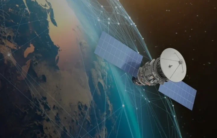
The National Aeronautics and Space Administration is accelerating its strategy to blend private-sector Earth observation assets with its legacy fleet of scientific spacecraft, aiming to bolster global climate tracking, disaster response, and environmental research. Through the Commercial Satellite Data Acquisition (CSDA) Program, managed by author Joseph Smith, the agency has increasingly relied on commercially procured high-resolution imagery and datasets to bridge critical data gaps. On September 14, 2026, the program announced a comprehensive upcoming webinar designed to update researchers, commercial partners, and the public on the initiative’s latest expansions, licensing updates, and calibration methodologies.
The webinar serves as a public checkpoint for a program that has rapidly evolved from a pilot initiative into a foundational pillar of NASA’s Earth Science Division. By integrating commercial capabilities—ranging from high-frequency revisit rates to specialized tasking tools—NASA seeks to provide its funded researchers with unprecedented visibility into rapidly changing environmental phenomena, such as urban heat islands, deforestation fronts, glacial melting, and agricultural yields.
Main Facts of the Commercial Satellite Data Acquisition Program
At its core, the CSDA Program functions as a bridge between commercial Earth observation companies and the global scientific research community. While NASA maintains a stellar reputation for operating sophisticated, flagship missions like Landsat, the ICESat series, and various Earth Observing System (EOS) satellites, these public assets cannot always match the high-resolution, high-frequency, or taskable nature of modern commercial constellations.
The program operates on a structured framework that accomplishes three primary goals. First, it secures licensed access to high-quality commercial data for NASA-funded researchers and select federal partners. Second, it rigorously assesses data quality through collaborative calibration and validation (cal/val) partnerships, ensuring that commercial products meet rigorous scientific standards. Third, it funds targeted application use cases to demonstrate how commercial observations can be translated into actionable research, policy insights, and operational disaster management solutions.
The upcoming webinar is structured to unpack these core pillars in meticulous detail. Key topics on the agenda include a breakdown of the diverse data modalities currently accessible through the program, recent revisions to the vendor evaluation pipeline, updates regarding the newly established calibration and validation initiatives, and status reports on existing task orders with contracted data providers. Furthermore, presenters are expected to guide attendees through the intricacies of end-user licensing agreements, navigating data access protocols, leveraging new data archives, and mastering the advanced tasking capabilities embedded within the Satellite Data Explorer interface.
Chronology and Evolution of NASA’s Commercial Data Strategy
The integration of commercial data into NASA’s scientific workflow did not happen overnight. It represents a deliberate paradigm shift in how federal agencies procure and utilize space-based infrastructure.
The conceptual groundwork for the CSDA Program began in the mid-2010s, as the commercial small-satellite industry experienced an explosive growth boom. Private companies began launching constellations capable of imaging the entire Earth’s landmass daily, or even multiple times a day, at resolutions previously unavailable outside of classified national security systems. Recognizing the immense potential value of these datasets for civilian science, NASA launched a pilot evaluation in 2017 to test the feasibility of acquiring commercial small-sat data and incorporating it into federally funded research.
By 2020, following successful pilot evaluations that proved the scientific utility of commercial constellations, NASA formally established the CSDA Program as an ongoing operational activity. The agency recognized that relying solely on traditional, multi-year government satellite development cycles left gaps in temporal resolution that commercial operators were uniquely positioned to fill.
Throughout 2021 and 2022, the program expanded its vendor base, onboarding major commercial imagery providers such as Planet, Maxar, and Spire Global, among others. These contracts allowed NASA-affiliated researchers to tap into vast archives of optical imagery, radio occultation data for weather forecasting, and Synthetic Aperture Radar (SAR) products.
By 2024 and 2025, the volume of ingested data scaled exponentially, prompting the agency to develop sophisticated discovery tools like the Satellite Data Explorer. This web-based platform was designed to streamline how researchers search, visualize, and download multi-petabyte commercial archives. The current landscape in 2026 reflects a mature, institutionalized program where commercial data is no longer viewed as a mere supplement, but as an equal partner to NASA’s internal science missions.
Supporting Data and Technological Capabilities

To understand the scale and impact of the CSDA Program, one must examine the sheer volume and diversity of data flowing through its portals. Commercial constellations offer distinct advantages that complement NASA’s classic architecture.
Traditional scientific satellites often operate in orbits optimized for global coverage over long periods, meaning they might revisit a specific location once every several days or weeks. In contrast, commercial constellations often utilize constellations of dozens or even hundreds of spacecraft in low-Earth orbit. This enables high-frequency revisits, allowing scientists to monitor dynamic events—such as the progression of a wildfire, the aftermath of an earthquake, or the rapid flooding of a river basin—in near real-time.
Under the current framework of the program, eligible researchers gain access to several distinct data modalities:
- High-Resolution Optical Imagery: Providing sub-meter resolution pixels capable of identifying individual structures, agricultural field boundaries, and localized environmental degradation.
- Radio Occultation Data: Leveraging signals from Global Navigation Satellite Systems (GNSS) as they pass through Earth’s atmosphere, supplying critical atmospheric temperature, pressure, and water vapor profiles to improve meteorological and climate models.
- Synthetic Aperture Radar (SAR): Allowing all-weather, day-and-night imaging capable of penetrating cloud cover and dense forest canopies to measure surface deformation, soil moisture, and sea ice extent.
The integration of these datasets requires rigorous quality control. Because commercial sensors are built and calibrated by private entities under varying engineering standards, NASA’s calibration and validation initiatives are crucial. By comparing commercial observations against ground-truth measurements and well-characterized federal instruments, scientists can correct for radiometric and geometric biases, ensuring that research papers published using commercial data maintain the highest standards of scientific reproducibility.
Official Responses and Institutional Perspectives
Leadership across NASA’s Earth Science Division has consistently championed public-private partnerships as a cost-effective and scientifically robust method for monitoring a changing planet. While government-funded missions remain the gold standard for long-term climate data records—where consistency over decades is vital to detecting subtle global trends—commercial data excels at tactical, high-resolution problem-solving.
In previous agency statements regarding commercial data integration, NASA officials emphasized that the democratization of high-end Earth observation data empowers a much broader community of researchers. Historically, high-resolution commercial imagery was cost-prohibitive for academic institutions, state and local governments, and independent researchers. By centralizing the procurement process and negotiating broad scientific end-user licensing agreements, the CSDA Program effectively removes financial barriers to entry.
Industry stakeholders have similarly praised NASA’s approach. Commercial Earth observation companies benefit from a stable, prestigious anchor tenant that validates the scientific utility of their products. This institutional backing often translates into increased investor confidence and accelerates technological innovation within the private aerospace sector. Furthermore, the feedback loop established through NASA’s calibration and validation partnerships allows commercial vendors to refine their sensor calibration pipelines, ultimately improving the quality of their products for all global customers.
Broader Impact and Scientific Implications
The implications of the CSDA Program extend far beyond academic research, directly influencing disaster response, resource management, and climate adaptation strategies worldwide.
When natural disasters strike—such as hurricanes, volcanic eruptions, or major floods—emergency management agencies require immediate situational awareness. Traditional satellite tasking queues can be slow to adjust, but commercial providers often possess the agility to re-task constellations within hours. By channeling these rapid-response datasets through NASA infrastructure, federal and international disaster response teams can more accurately map impacted areas, direct rescue resources, and assess infrastructure damage with unprecedented speed.
In the realm of climate science, the fusion of public and private data streams allows for more granular modeling of carbon cycles, hydrological shifts, and ecosystem health. For instance, combining coarse-resolution, long-term soil moisture data from NASA’s SMAP (Soil Moisture Active Passive) satellite with high-resolution commercial optical and thermal imagery enables agricultural researchers to track drought stress at the individual farm level. This localized insight is vital for global food security initiatives in the face of shifting weather patterns.
As the CSDA Program continues to mature through initiatives like the upcoming webinar, its framework may well serve as a blueprint for other federal agencies and international space bodies looking to harness the dynamism of the new space economy. By fostering transparent evaluations, robust licensing frameworks, and collaborative scientific validation, NASA is demonstrating how public institutions can successfully leverage private-sector innovation to serve the global public good.